UPTOWN FLOOD
RISK GUIDANCE
Flood Risk Guidance
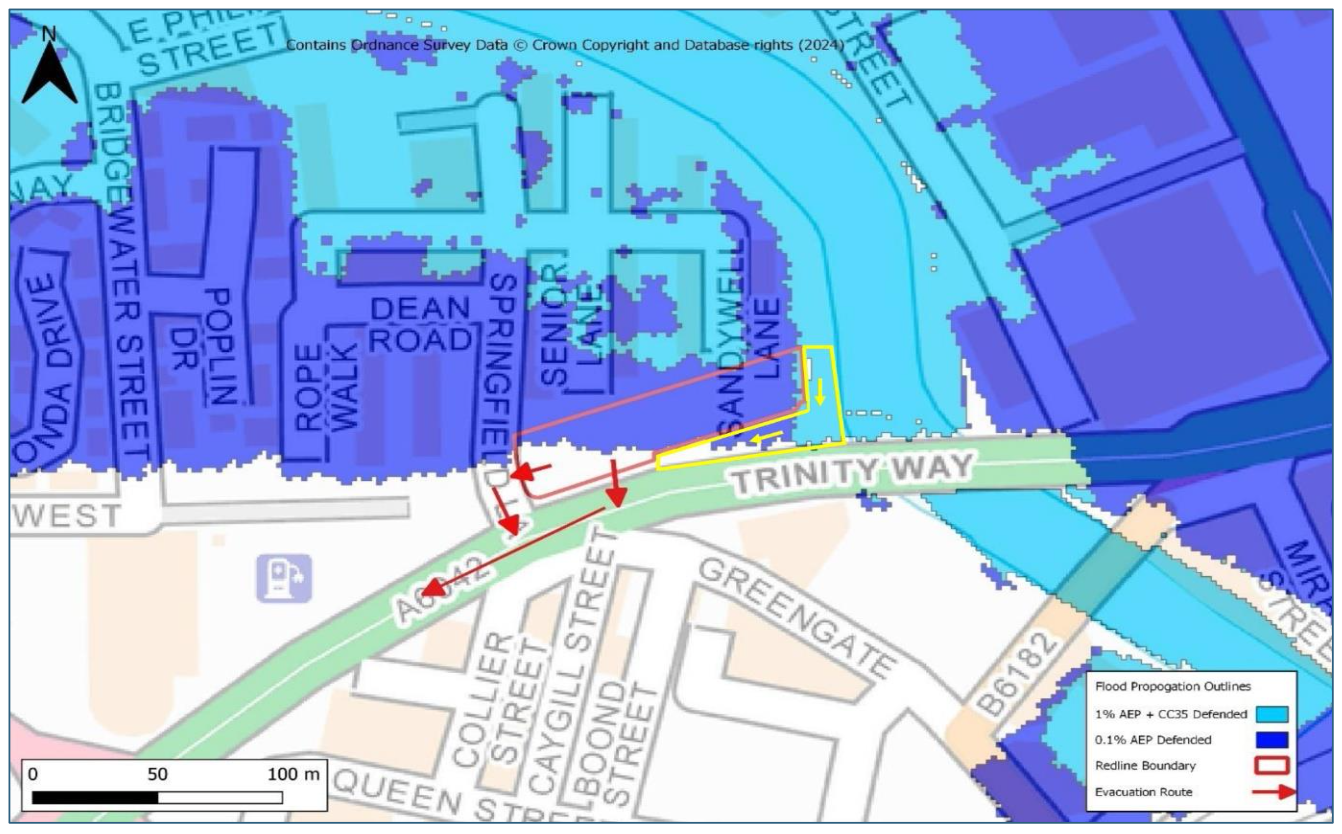
The Environment Agency (EA) Flood Map for Planning indicates that the adjacent residential development at Springfield Lane and footpath edged yellow falls within Flood Zone 2 and is therefore at medium risk of flooding from the River Irwell.
The modelling study identifies that the safe access and egress to the site will not always be available in these extreme events and following the failure of defences.
When extreme flood events are forecast, the buildings and footpath may need to be evacuated following the issuing of a flood warning. Although residential properties are not located on the ground floor, the possible depth of flood water will result in the buildings becoming inaccessible. Due to the plant rooms being located on the ground floor, utility service may be disrupted by flooding and for a period post event.
The evacuation route is shown in below. Everyone should evacuate via Trinity Way or Springfield Lane onto Trinity Way, then moving west away from the river. It is recommended people seek safe refuge with friends or family or contact the local authority to understand provisions that have been set up.

